 |
327 pm: strengthening updraft with inflow band west of Dighton KS |
 |
337 pm: supercellular characteristics develop as storm starts to turn NNE |
 |
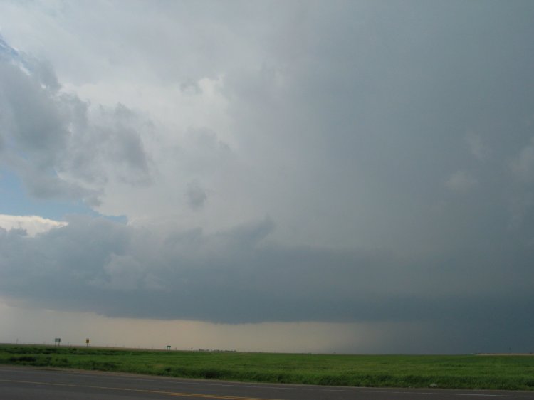
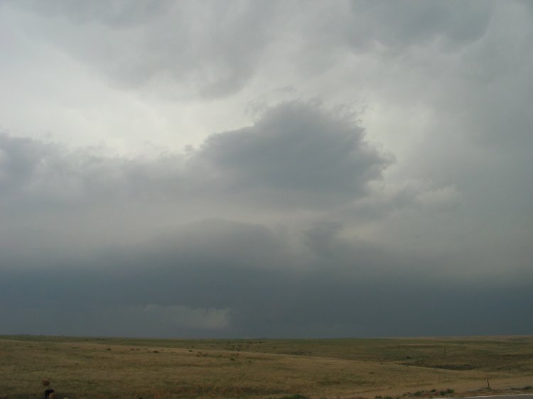
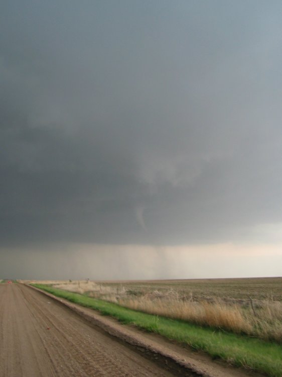
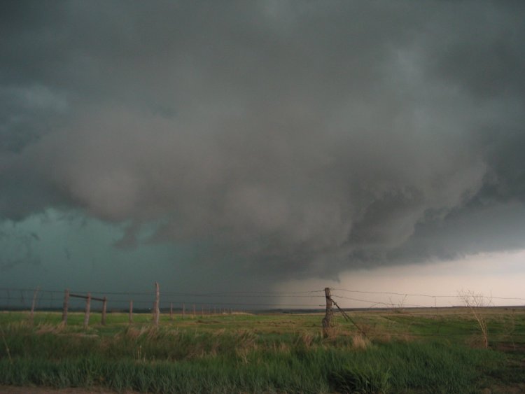
344 pm: cloud base lowerings southwest of Gove. The storm developed a pronounced (if low contrast) wall cloud as it continued west of Gove, with very strong ESE inflow winds. As it reached I-70, the storm turned more northerly and structure became messier. |
 |
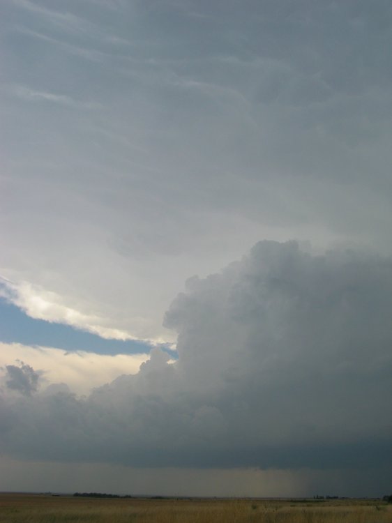
456 pm: same supercell now turning NNW to the southwest of Hoxie KS. Cloud base structure had just recently appeared to improve with a low-level meso/clear slot (as in photo)... interestingly, right at the time I was preparing to abandon it and commit to a beefier supercell developing well to my south. While en route, I bypassed an intermediate and similarly pre-tornadic storm southwest of Grainfield on I-70; at the time it had a distinct, non-rotating wall cloud with a massive wall of rain encroaching behind it. |
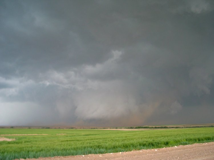 |
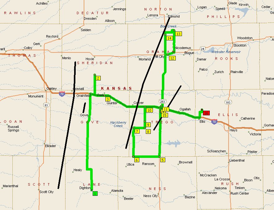
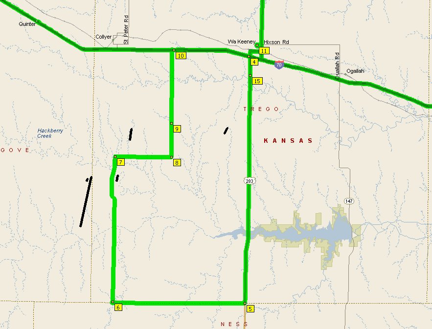
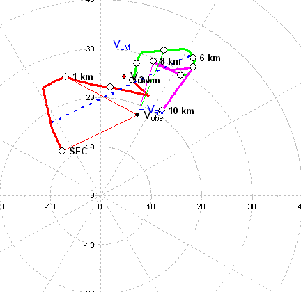
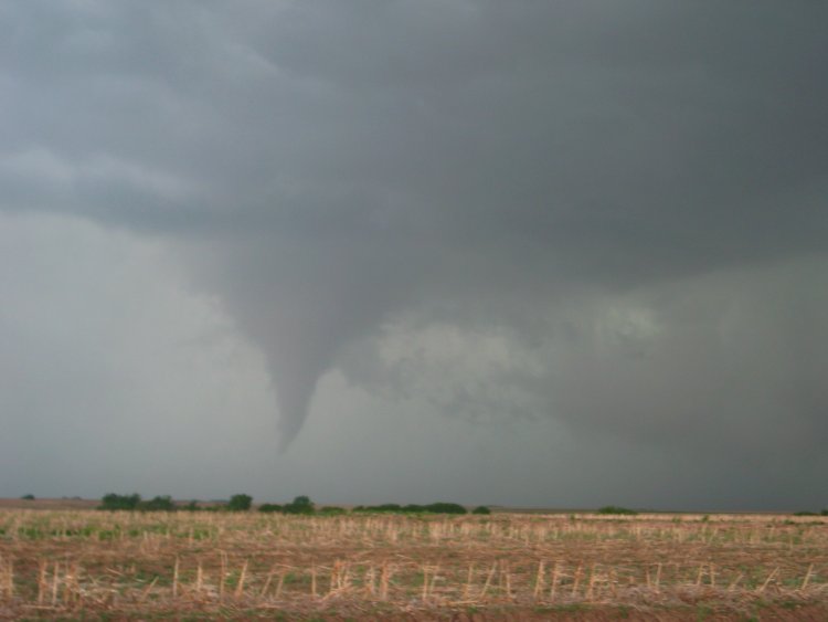
Taking Highway 283 south of Wakeeney and then the Trego-Ness county line gravel road 12 miles west, I intercepted my target storm about 6 miles northeast of Utica KS at 608pm. I was initially surprised by the relatively high-based and linear structure. However, as I headed north, rapid cloud base lowering beneath a classical RFD surge occurred immediately to my northwest (video only... captures forthcoming.) Within minutes, a violently rotating low-level mesocyclone was born, with an impressive train of RFD-driven dirt blasting in front of it (615pm, as in photo... view looking NW). The dark mass beneath the visible low-level meso contained a tornadic circulation intermittently during the next several minutes, which WFOGLD appears to have rated as EF-1 based on damage to a home and outbuildings. |
 |
615pm: same. The structure in this scene was somewhat reminiscient of the Hallam NE storm during its first large tornado near Alexandria... four years ago to the day. |
 |
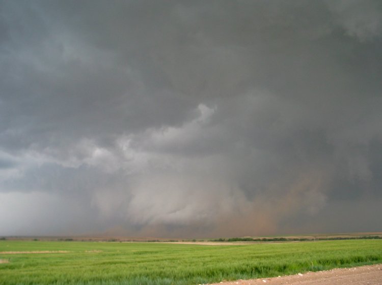
616pm: same. Over the next couple minutes, the tornadic circulation became rain-wrapped while my attention was diverted to a new tornado. |
 |
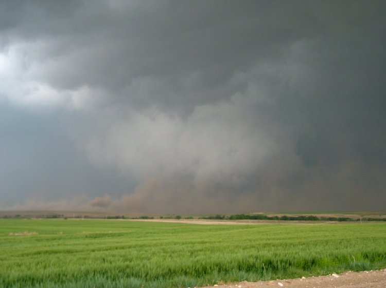
626pm: the new tornado developed to the ENE on the forward lip of the meso (view looking NNE)... a classical area for anticyclonic spinups. The tornado persisted for four minutes, with a fairly dramatic ropeout as the condensation funnel aloft tilted and a substantial shower of dusty debris formed at ground level (video only). |
 |
632 pm: a third tornado developed back to the west, behind the primary meso. It lasted about one minute. |
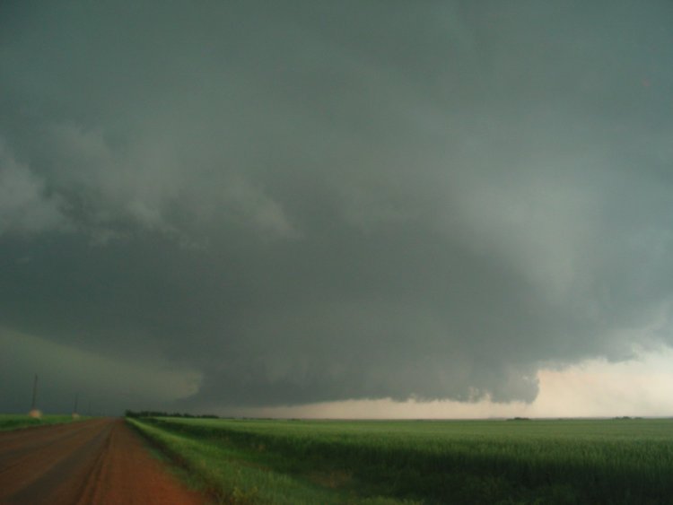 |
637 pm: while my attention had been diverted to the previous two tornadoes, the primary low-level mesocyclone rapidly re-emerged from the rain... larger and more low-based than before. It had a rather incredible appearance as it began to cross the road in front of me. The photo above shows my high-contrast view of the meso after it had passed my longitude. Violent merry-go-round rotation suddenly ensued, and a dusty tornado occurred for a couple minutes beneath the leading (right-hand in photo) edge of the circulation. |
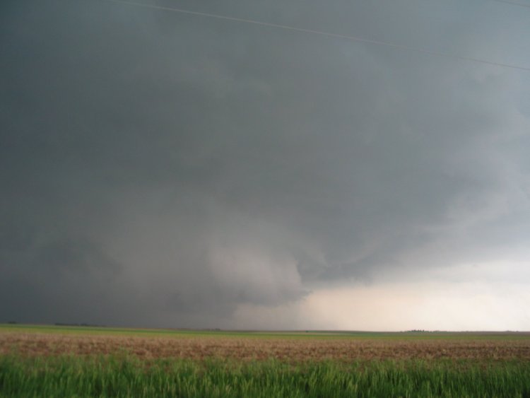 |
642 pm: I turned east as a wet RFD surge rapidly overtook the low-level mesocyclone (and nearly my car, too)... obscuring the tornado. I turned north toward I-70, and over the course of the next 10 minutes the storm transitioned into a typical HP supercell. |
 |
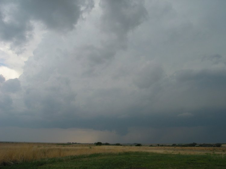
732 pm: same storm much later northeast of Hill City. I dropped back south of Wakeeney and observed a final tornado at darkfall with a new storm passing over Trego center. It was a truncated cone around 8:48pm... lasting a minute or two just as that storm transitioned to an HP as well. |