|
This was supposed to be my first chase of the year, the day after getting home from a work trip... but a mix-up by Northwest Airlines had me awake the entire previous night and getting home to KC the day of around 9 A.M. I chose to crash rather than chase on no sleep, especially being concerned about the low CAPE-intense deep layer shear combo and fast storm speeds. It was probably just as well, as the ~4 tornadic storms were not only moving at 40-60kts, but also embedded within elongated quasi-linear convection and only intermittently tornadic. That, and the surface warm front jumped north well into Iowa, and I'd probably never have recovered in time as models did a poor job at predicting its northward push. Other than that, the 00Z NAM the night before did very nicely with this event.
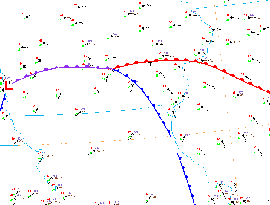
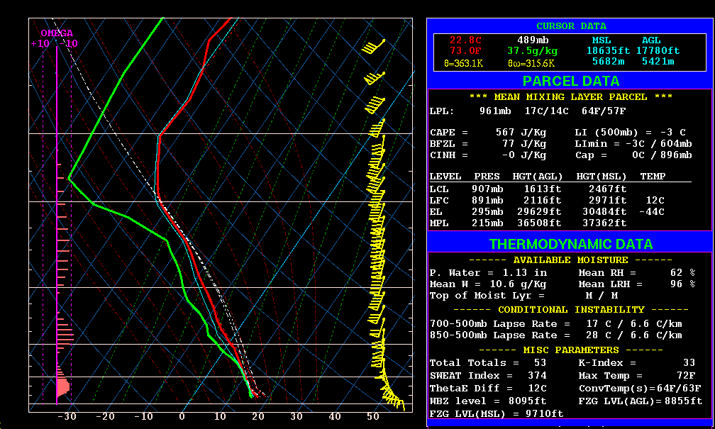
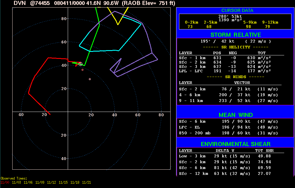
The only tornado I've seen photographed on this day occurred around 00Z near the town of North English IA, immediately south of the surface warm front amidst surface winds ~13020kt and ~63/59F. This was the last tornado of the day, and it looked to be pretty strong/sizeable (if short-lived based on the survey)... traveling within a multi-layered cloud environment as the arc of storms spread from the dry slot back into the stratus. I used NSHARP for the hodographs, as a large near-surface kink on the 00Z DVN RAOB wasn't resolved by NWSUNR's hodograph program (which thus "under-did" the 0-1 km SRH by ~100 m2/s2 against NSHARP). The NAM model sounding I modified from Ottumwa (OTM) was at 22Z, before the sounding "activiated" with extreme lift/convection. Its surface wind is a bit too backed and as usual the hodograph is a bit smoothed-looking (no kinks)... but its SRH values (0-1 km ~400-450 m2/s2) are probably pretty close to reality with regard to the North English storm. The SPC Mesoanalysis page had 0-1 km SRH values in the 600-800 m2/s2 range for the tornadic storms in this event, but its 850mb winds were over-forecast and its storm motion too veered.
00Z surface analysis (North English IA tornadic storm denoted by "T")
22Z OTM modified NAM sounding/hodograph
MLCAPE: 567 j/kg MLCINH: 0 j/kg 0-3 km MLCAPE: 87 j/kg MLLCL: 492 m MLLFC: 645 m
storm motion: 195 @ 42 kts 0-1 km SRH: 421 m2/s2 0-3 km SRH: 614 m2/s2
00Z DVN hodograph
0-1 km SRH: 630 m2/s2 0-3 km SRH: 624 m2/s2
other links: |